EMO Atlas
EMO Atlas brings a searchable globe, public aircraft observations, modeled weather, Caribbean AIS ships, earthquake reports and public camera stills into one local dashboard.
Overview
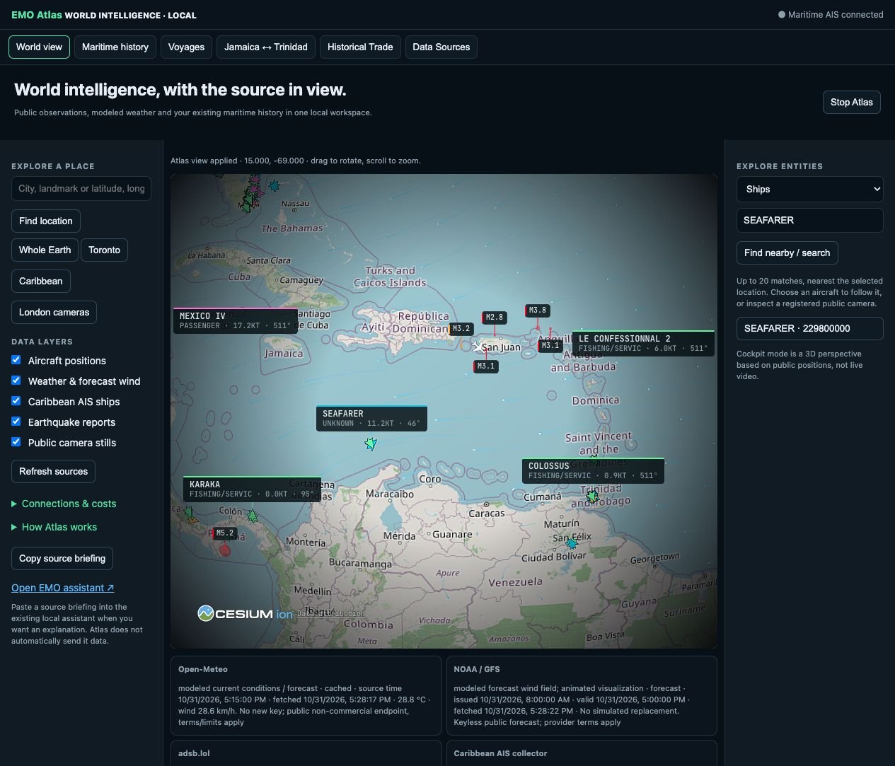
EMO Atlas is the main product name for the expanding workspace previously called EMO TIDE. The maritime collector, stored vessel history, voyages and Caribbean corridor views remain part of Atlas; they have not been replaced or discarded.
The world view combines selectable layers and separate provider adapters. Place and entity search, aircraft follow and a rendered 3D cockpit perspective are connected to the local globe. Source cards show observation or forecast time, caching and availability. Aircraft and ship search help users inspect the current feeds; aircraft can be followed on the rendered globe. Public camera coverage currently uses Transport for London still images, with clear attribution and no synthetic replacement when a frame is unavailable.
Current integrations have been checked against real Open-Meteo weather, NOAA/GFS wind, OpenSky aircraft snapshots, the existing Caribbean AIS collector, USGS earthquake reports and the TfL camera catalog. One camera image was also verified separately. A successful catalog response does not mean every listed camera is live or reachable.
The globe foundation is the open-source God’s Eye View project by Bilawal Sidhu and CesiumJS. EMO Atlas supplies the local product workspace, native controls, source adapters, evidence display and service lifecycle. Optional photorealistic imagery, street imagery, Ontario 511 cameras and cloud voice remain unconfigured. Satellite layers and aggregate road-traffic visualization remain future work. Provider terms and quotas apply, and commercial deployment may require suitable plans.
Atlas is a working local prototype, not a public monitoring service or navigation system. It does not offer private camera access, individual vehicle tracking or live cockpit video. Weather is modeled, wind is forecast, and public aircraft data can be delayed. The existing local EMO assistant can explain a briefing pasted by the user; Atlas does not automatically send it private data.
Related Projects